The NSW DPI Angler Access website, has the ability to provide you with a georeferenced map of a selected area showing access points. This is in the form of a special pdf. Internet access is required to connect to the access website, but the map created can be downloaded onto your phone for viewing offline.
The pdf map is used by an app called Avenza Maps to display your current location on the map without the need for mobile data connection.
Production of the map is a little complicated. The screenshots here display the process using a phone, but should be easier on desktop computer.
Go to the access website and zoom to the area of interest.
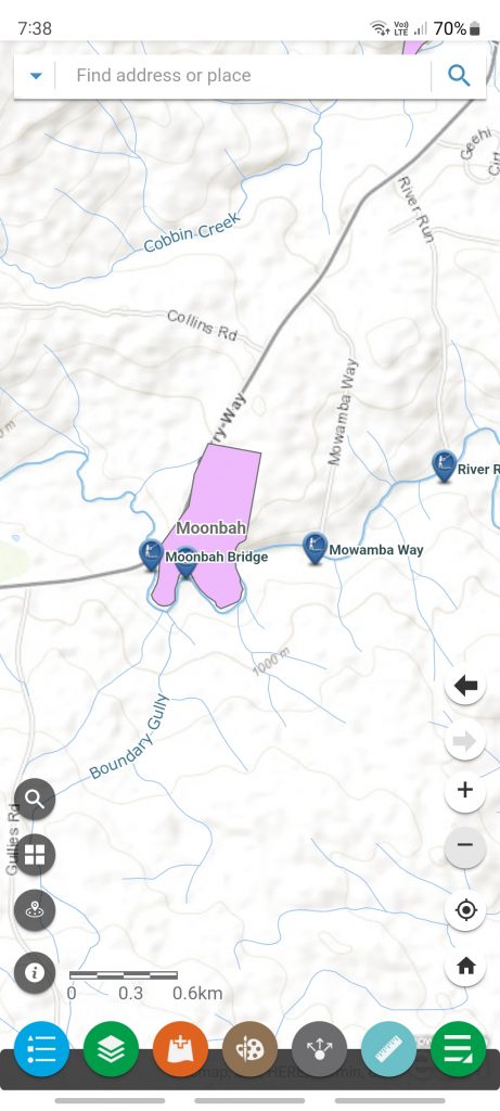
On my phone I couldn’t see the print button but is available via the green button at the bottom right of screen.
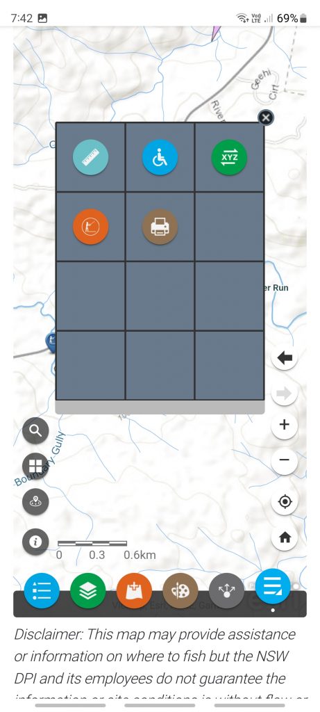
Press the brown print button.
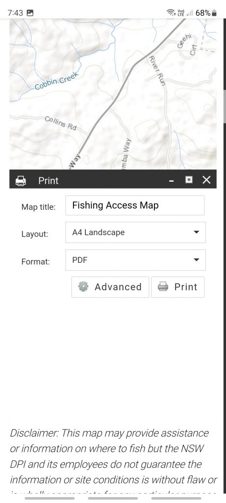
I tinkered with some of the advanced settings – not sure if it had any real effect, but I thought the map should be larger. I also opted for km scale.
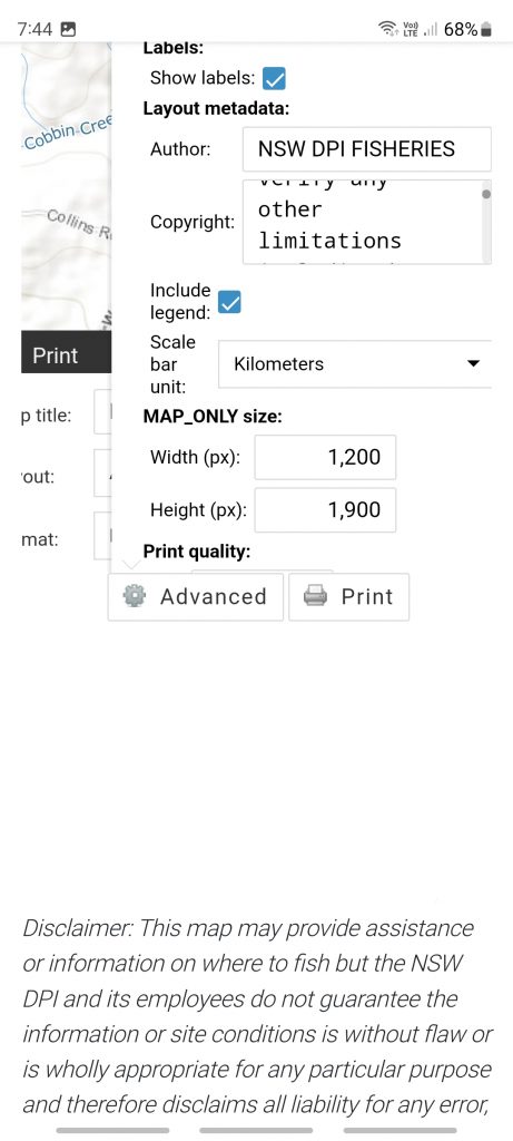
Then hit print button.
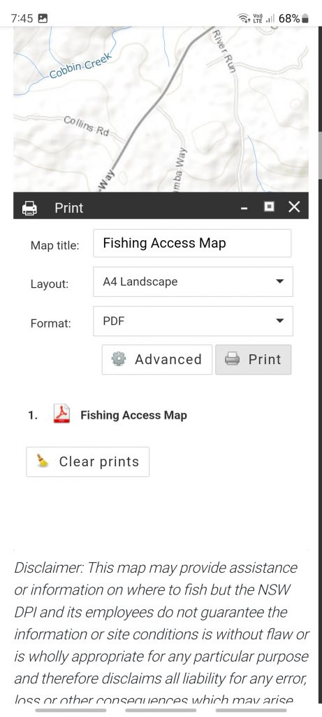
Then tap “1. Fishing Access Map”
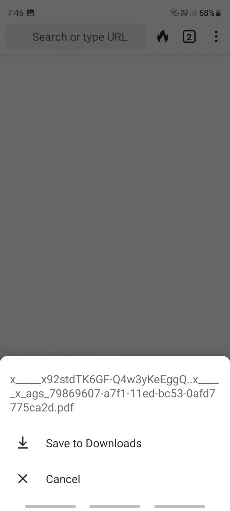
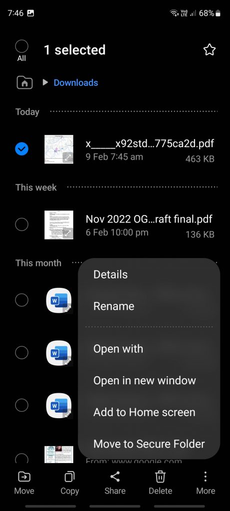
Tap ‘Save to Downloads’. Unfortunately it will be saved with the horrible name. I take steps via the app MyFiles to rename it.
When you open Avenza Maps, go to My Maps which shows maps you have already loaded. Here you can see I’ve got a number already. Unfortunately the free version of Avenza limits you to three maps … we’ll deal with that in a moment.
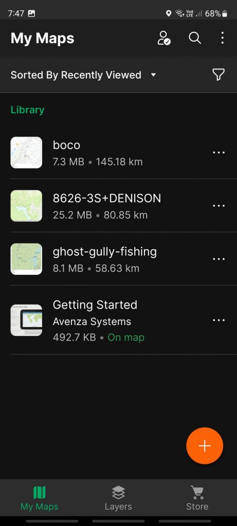
Press the orange + button
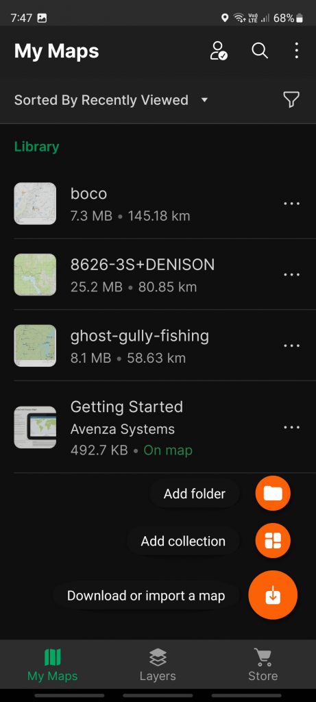
Press Download or import a map
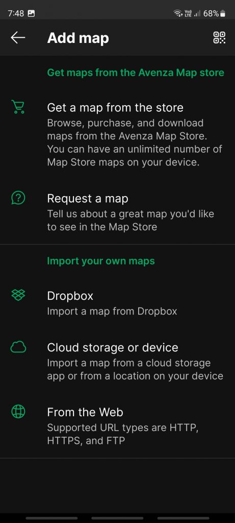
Press Cloud storage or device
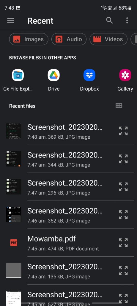
Here you can see my map file renamed as Mowamba. If you produced the pdf on your desktop and transferred to phone you may need to navigate to where you stored it. Click on your pdf map name
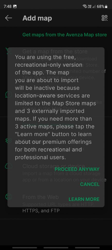
The message above is because of the 3 map limit, you will not see this when starting to use Avenza. Click on PROCEED ANYWAY
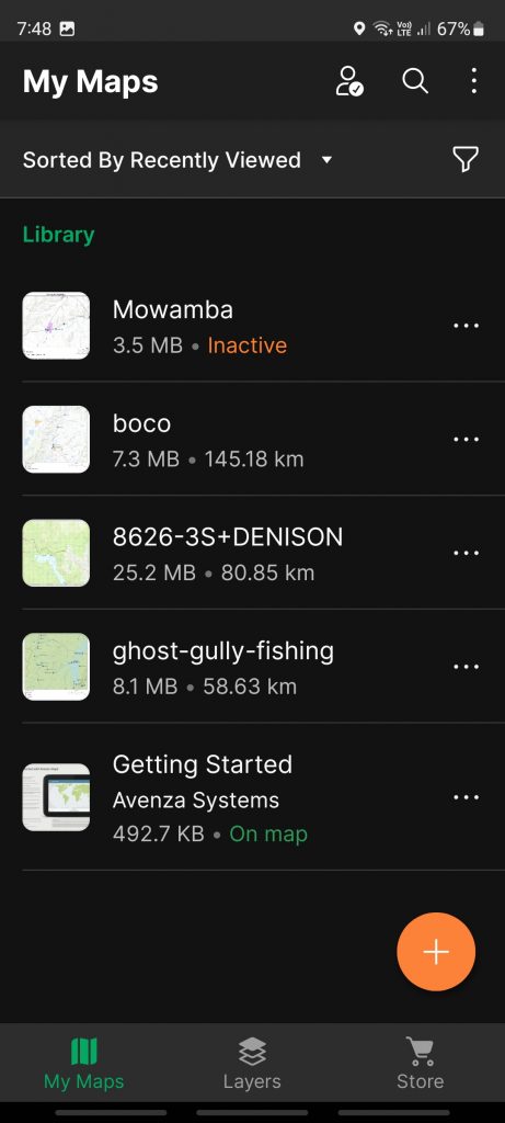
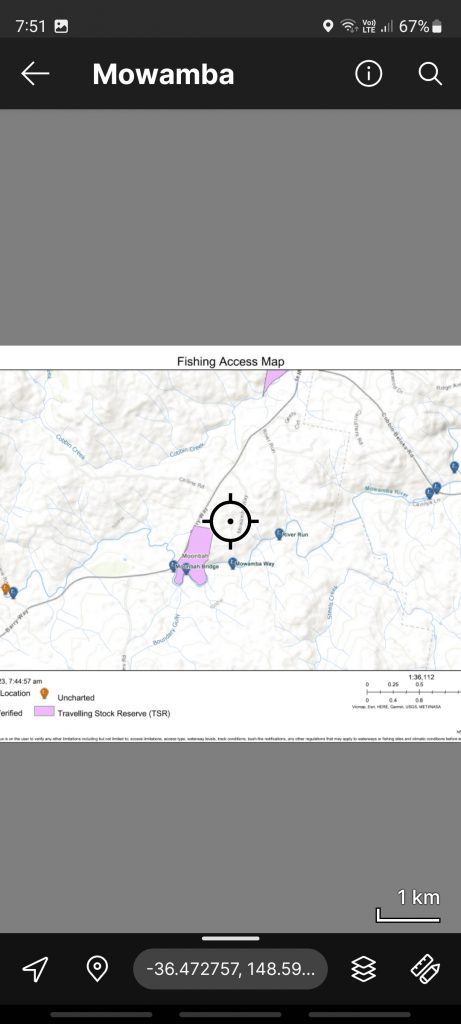
I tapped on the three dots next to an unwanted map and chose to delete it. I suspect the pdf remained on my phone somewhere so I could reload in the future. In due course I could tap on the Mowamba map
Talk to Bill sometime if the instructions are too confusing and get a live demo.
